Guam Map: Regions, Geography, Facts & Figures
|
Located on the world atlas in the western Pacific Ocean, Guam is the largest island in Micronesia and an unincorporated territory of the United States. The island is known for its beautiful beaches, rich Chamorro culture, and vibrant tourism industry. In this guide, we will explore the history, geography, and tourist attractions of Guam. If you want to discover more in-depth information on Guam as a country, check out our Guam Profile! Plus, test your country knowledge with our world geography quiz on the Pacific Ocean. |
|
 |
|
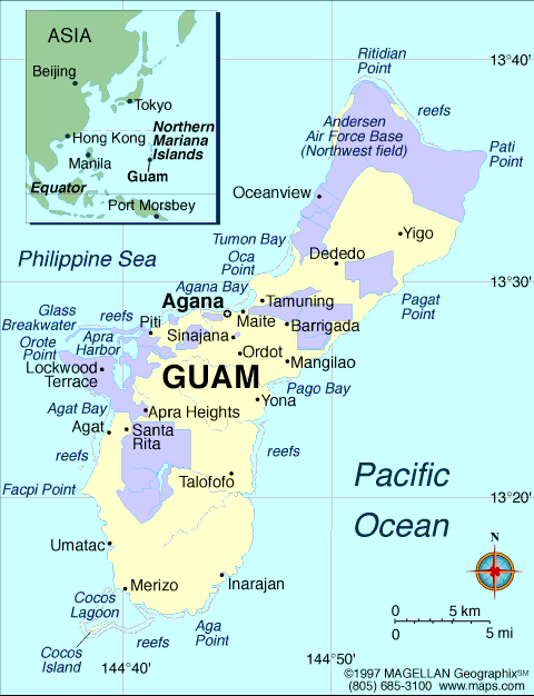
Guam Facts: HistoryGuam has a rich history dating back to 1500 B.C., when the Chamorro people first settled on the island. The island was first visited by Europeans in 1521, when Portuguese explorer Ferdinand Magellan arrived. Guam was colonized by Spain in 1668 and was later ceded to the United States in 1898 as a result of the Spanish-American War. During World War II, Guam was occupied by Japan for two and a half years before being retaken by the United States. Today, Guam remains a strategic military base for the United States in the Pacific. Guam Facts: GeographyWhen you look at the map of Guam, it is one of the small Pacific islands and is part of the Mariana Islands, west of the USA. The island is approximately 30 miles long and eight miles wide and is considered one of the Micronesia Islands. Climate and Wildlife in Guam Guam has a tropical climate, with average temperatures ranging from 80 degrees year-round. The island receives plenty of rainfall throughout the summer months, and typhoons are common in the fall. Guam is also home to a wide variety of wildlife, including flying foxes, giant geckos, monitor lizards, coconut crabs, and more. What Countries Are in Micronesia?The countries of the world that are located in Micronesia are:
Guam Facts: Tourist AttractionsGuam offers a wide variety of tourist attractions, including some of the most beautiful beaches, historic landmarks, and national parks. The capital city of Guam is Hagatna, and other major cities include Tamuning, Dededo, Inarajan, Merizo, Asan, Agat, Santa Rita, Yigo, Talofofo, Piti, Barrigada, Agana Heights, Umatac, Mongmong, Maite, and Yona. Guam is also home to Apra Harbor, one of the largest natural harbors in the Pacific. Some of the top tourist attractions in Guam include:
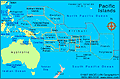
People Also Ask...If you're inspecting the Guam country map, you may have some queries about the region. Here are some of the most frequently asked questions, along with their answers. Where Is Guam Located?Guam is located in the Western Pacific Ocean and can be found on a world map in the region of Oceania, near the Philippines, Hawaii, and the Northern Mariana Islands. Is Guam Part of the USA?Yes, Guam is an unincorporated territory of the United States in the Western Pacific Ocean. It was ceded to the United States in 1898 as a result of the Spanish-American War and remains a strategic military base for the U.S. in the Pacific. Is Guam Closer to Japan or Hawaii?Guam is closer to Japan than Hawaii. It is located approximately 3,800 miles west of Hawaii and 1,500 miles east of Japan. What Time Zone Is Guam In?Guam is in the Chamorro Standard Time zone, which is 10 hours ahead of Coordinated Universal Time (UTC+10). |
|
|
|
|
|
Encyclopedia: Guam More on Guam: More: Territories, Colonies, and Dependencies · Countries of the World · Oceans & Seas · U.S. Distance Calculator · U.S. Latitude/Logitude Search
|
Related Content |
Trending
Here are the facts and trivia that people are buzzing about.


