South America: Maps and Online Resources
South America is the fourth largest continent in the world, situated in the Western Hemisphere and Southern Hemisphere, with a relatively small portion in the Northern Hemisphere. It is surrounded by the Atlantic Ocean to the east and the Pacific Ocean to the west. With North America and the Caribbean Sea above, both South America and Central America can be broadly described as Latin America. The continent is home to a diverse range of cultures, languages, and landscapes, spread across the South American continent.
Test your continent knowledge with our Can You Name These South American Landmarks? Quiz!
Click on a country for a more detailed map, or try our index.
History of South America
South America is a land rich in history, with evidence of human habitation dating back over 12,000 years. The continent was home to several indigenous civilizations, including the Inca, Maya, and Aztecs. In the 16th century, European explorers arrived in South America, leading to the colonization of the continent. Officials from Spain and Portuguese leaders were the major colonial powers, and their influence can still be seen in the region's language, culture, and architecture.
Geography of South America
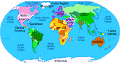
The physical map of South America is made up of 12 countries: Argentina, Bolivia, Brazil, Chile, Colombia, Ecuador, Guyana, Paraguay, Peru, Suriname, Uruguay, Venezuela, and French Guiana. The continent is home to some of the world's most stunning natural landscapes, including the Andes Mountains, the Amazon River, and the Tierra del Fuego. The region is also known for its beautiful beaches, vibrant cities, and diverse wildlife.
Major Cities
South America is home to several vibrant and bustling major and capital cities, including Rio de Janeiro, Buenos Aires, Sao Paulo, Bogotá, Lima, Santiago, Caracas, Maracaibo, Quito, and Salvador. These cities offer a unique blend of history, culture, and modernity, spread across the political map of South America.
Tourist Attractions in South America
South America offers a wide range of tourist attractions, from historic landmarks to natural wonders. Some of the most popular destinations include the following.
- Andes Mountains: The Andes Mountains are the longest mountain range on the world map, stretching over 7,000 kilometers. The region is home to several popular tourist destinations, including Machu Picchu in Peru and the Atacama Desert in Chile.
- Amazon River: The Amazon River is the largest river in the world, running through several South American countries along the Amazon Basin, including Brazil, Peru, and Colombia. The region is known for its stunning wildlife and lush rainforests.
- Beaches: South America is home to some of the world's most beautiful beaches, including Copacabana in Brazil, La Plata in Argentina, and Ipanema in Uruguay.
- Falkland Islands: The Falkland Islands are a British dependency located off the coast of Argentina. The islands are known for their stunning landscapes and unique wildlife, including penguins and sea lions.

People Also Ask...
If you're inspecting country maps of South America, you may have some queries about the region. Here are some of the most frequently asked questions, along with their answers.
How Many Countries in South America?
South America contains 12 individual countries, each with its own history: Argentina, Bolivia, Brazil, Chile, Colombia, Ecuador, Guyana, Paraguay, Peru, Suriname, Uruguay, and Venezuela.
What Is the Capital of Brazil?
The capital of Brazil is Brasilia. The country is known for its vibrant culture and Brazilian coffee beans, which are some of the best in the world, and is the largest country in South America by both area and population.
What Is South America Most Famous For?
South America is famous for its music, dance, and cuisine, which are a fusion of indigenous, European, and African influences. Samba, tango, and salsa are some of the continent's most popular musical styles, while traditional dances like the Argentine tango and Brazilian samba have gained worldwide recognition.
South American cuisine is also renowned for its hearty meat dishes and spicy flavors, making it a must-try for foodies. From the hearty meat dishes of Argentina to the spicy flavors of Peru, there is something for everyone to enjoy in South American cuisine.
What Major Islands Are in South America?
South America has several major islands, including the Galapagos Islands, the Falkland Islands, and the Tierra del Fuego archipelago. The Galapagos Islands are known for their unique wildlife, while the Falkland Islands are a British Overseas Territory with a rich cultural history. The Tierra del Fuego archipelago is located at the southern tip of South America and is shared by Argentina and Chile.
Country Maps: South America
Territory and Dependency Maps: South America
More Geographic Information
 |
Trending
Here are the facts and trivia that people are buzzing about.


