Caribbean Map: Regions, Geography, Facts & Figures
The Caribbean islands is a region located east of Central America in the Caribbean Sea, and has a rich history and culture that dates back to the 15th century. The area consists of over 700 islands, islets, reefs, and cays, each with its own unique identity and history.
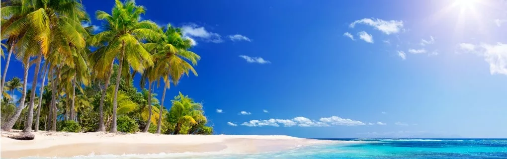
The Caribbean is not only known for its breathtaking beaches and crystal-clear waters, but also for its diverse flora and fauna, including exotic bird species and marine life. The region is a popular tourist destination, attracting millions of visitors every year to experience its tropical climate, indulge in delicious and diverse cuisine, and enjoy the vibrant music that can be heard on every corner.
If you want to discover more in-depth information on the Caribbean islands as an area, check out our Caribbean and Atlantic Islands Profile!
Test your continent knowledge with our Caribbean geography Islands Quiz!
Click on an island or country for a more detailed map, or try our map index.

History of the Caribbean Islands
The Caribbean islands were originally inhabited by indigenous peoples, including the Carib and the Arawak. In the 15th century, Europeans began to colonize the islands, with the Spanish, British, French, and Dutch establishing colonies throughout the region. The islands played a significant role in the transatlantic slave trade, with millions of Africans brought to the region to work on sugar plantations. Today, the Caribbean islands are independent nations, with a fascinating history and extensive cultural heritage.
Geography of the Caribbean Islands
The Caribbean islands are located in the Caribbean Sea, which is bordered by the North and South American continents, the Atlantic Ocean, and the Gulf of Mexico. The region includes over 7,000 islands, islets, and cays, with a total land area of approximately 239,681 square kilometers. The islands are divided into three main groups: the Greater Antilles, the Lesser Antilles, and the Bahamas. The region is known for its diverse landscapes, including sandy beaches, coral reefs, rainforests, and mountains.
The Greater Antilles
The Greater Antilles include the largest islands in the Caribbean, including Cuba, Jamaica, Puerto Rico, and Hispaniola (which is shared by the Dominican Republic and Haiti).
The Lesser Antilles
The Lesser Antilles are a group of small islands located to the east of Puerto Rico. The islands are divided into two groups: the Leeward Islands and the Windward Islands, off the coast of Venezuela, and near Bonaire and Curaçao Islands.
The Bahamas
The Bahamas is a group of islands located to the northeast of Cuba and southeast of Florida. It includes over 700 islands and is known for its beautiful beaches and crystal-clear waters.
Tourist Attractions in the Caribbean Islands
The Caribbean islands are a popular tourist destination, with many beautiful beaches, vibrant culture, and historic landmarks. Here are some of the top tourist attractions by region.
Jamaica
An island famous for vibrant culture, reggae music, and lush landscapes, including:
-
Montego Bay: Beach town with resorts, beaches, and nightlife.
-
Dunn's River Falls: Tourist attraction with cascading waterfalls and swimming.
-
Bob Marley Museum: Museum dedicated to the life of Bob Marley.
-
Blue Mountains: Scenic mountain range with hiking and coffee plantations.
Puerto Rico
An island near the West Indies known for music, beaches, and history, including:
-
El Yunque National Forest: Rainforest with hiking trails and waterfalls.
-
Old San Juan: Historic district with colorful buildings and landmarks.
-
Bioluminescent Bay: Natural wonder with glowing plankton in the water.
-
Castillo San Felipe del Morro: Fortress with stunning views and history.
Bahamas
A Caribbean island chain with pristine beaches and culture, including:
-
Atlantis Paradise Island: Resort with a water park and marine habitats.
-
Exuma Cays: Scenic islands with clear waters and swimming pigs.
-
Pink Sands Beach: Beautiful beach with pink sand in the Bahamas.
-
Andros Island: Island with beaches, diving, and natural wonders.
Dominican Republic
A tropical paradise with rich history and culture, including:
-
Punta Cana: Beach resort town with all-inclusive resorts and golfing.
-
Santo Domingo: Colonial city with historic landmarks and culture.
-
Samaná Peninsula: Scenic peninsula with beaches and natural wonders.
-
Cabarete: Beach town with water sports and nightlife.
Cuba
An island with incredible history, cultural traditions, and music, including:
-
Havana: The capital of Cuba, known for its colorful architecture, vintage cars, and lively culture.
-
Varadero Beach: A popular beach resort town with white sand beaches and clear waters.
-
Trinidad: A colonial town with colorful buildings, cobblestone streets, and cultural heritage.
-
Viñales Valley: A scenic valley renowned for its tobacco fields, mogotes (limestone hills), and outdoor activities.
Lesser Antilles
A chain of small islands that have incredible natural landscapes, including:
-
Barbados: An island known for its beaches, coral reefs, and British colonial heritage.
-
Antigua and Barbuda: A twin-island nation in the Lesser Antilles famed for beaches, sailing, and historic landmarks.
-
St. Lucia: A volcanic island with beaches, rainforests, and Pitons (twin peaks).
-
Grenada: Incredible beaches, spice industry, and historic landmarks.
The Virgin Islands
Another scenic chain of Caribbean islands with beaches galore, including:
-
St. Thomas: Beaches, duty-free shopping, and historic sites.
-
St. John: Stunning beaches, hiking trails, and coral reefs.
-
St. Croix: Historic sites, beautiful beaches, and a rainforest.
-
Virgin Gorda: Incredible beaches and unique rock formations, and the Baths National Park.
People Also Ask...
If you're inspecting a map of Caribbean Islands, you may have some queries about the region. Here are some of the most frequently asked questions, along with their answers.
What Are the 12 Countries of the Caribbean?
The 12 countries of the Caribbean are Antigua and Barbuda, Bahamas, Barbados, Cuba, Dominica, Dominican Republic, Grenada, Haiti, Jamaica, Saint Kitts and Nevis, Saint Lucia, and Saint Vincent and the Grenadines. These countries are considered part of the Caribbean region due to their location and shared cultural heritage. Trinidad and Tobago is considered a 13th sovereign nation, but is located on South America’s continental shelf.
Is the Caribbean Part of USA?
No, the Caribbean is not part of the USA. The Caribbean is a separate region located below North America, and above South America. While some Caribbean countries are territories of the United States, such as Puerto Rico and the U.S. Virgin Islands, the region as a whole is not part of the U.S.
What Are the 3 Main Caribbean Islands?
The three main Caribbean islands are Cuba, Hispaniola (shared by the Dominican Republic and Haiti), and Puerto Rico. These three islands are the largest by land area and population, and are important cultural, political, and economic centers in the Caribbean region.
Why Do They Call it the Caribbean?
The Caribbean was named by Christopher Columbus during his 1492 voyage to the Americas. He named the region after the Carib people, a group of indigenous people who lived in the Lesser Antilles. The name "Caribbean" has been used to describe the region ever since.
What Is the Currency Used in the Caribbean?
The currency used in the Caribbean varies by country, with the U.S. dollar being widely accepted in many places. Other currencies used in the region include the Eastern Caribbean dollar, the Jamaican dollar, and the Bahamian dollar.
Country Maps: Caribbean
Territory and Dependency: Caribbean
|
Note: The Caribbean Islands are part of the North American continent.
|
|
|
 |
Trending
Here are the facts and trivia that people are buzzing about.


