Australian External Territories
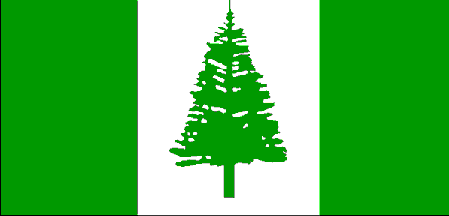
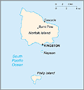
Norfolk Island (13.36 sq mi; 34.6 sq km) was placed under Australian administration in 1914. The population is 2,210 (July 2014 est.). Formerly a notorious penal colony, Norfolk Island became home to the entire population of Pitcairn Island in 1856. The 194 residents of tiny Pitcairn—all of whom were the descendants of the mutineers from the HMS Bounty and their Tahitian wives—embarked on the 3,700-mile journey to Norfolk because of overpopulation. Many Norfolk residents can trace their genealogy directly to the adventurers from Bounty.
 |
 Source: The World Factbook 2003 |
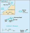
Ashmore and Cartier Islands (1.93 sq mi), situated in the Indian Ocean off the northwest coast of Australia, came under Australian administration in 1934.
 Source: The World Factbook 2005 |
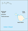
Heard Island and the McDonald Islands (159 sq mi; 412 sq km), lying in the sub-Antarctic, were placed under Australian administration in 1947. The islands are uninhabited.
See also A History of Heard Island.
 Source: The World Factbook 2005 |
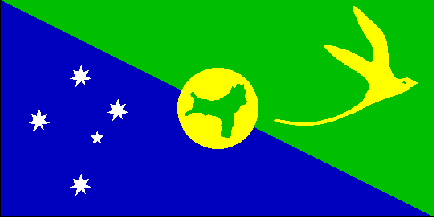
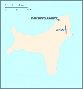
Christmas Island (52 sq mi; 135 sq km) is situated in the Indian Ocean. It came under Australian administration in 1958. Two-thirds of the island is now a national park. The population is 1,530 (2014 est.).
 |
 Source: The World Factbook 2003 |
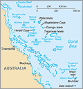
Coral Sea Islands (400,000 sq mi; 1,036,000 sq km, but only a few sq mi of land) became a territory of Australia in 1969. There is no permanent population on the islands.
 Source: The World Factbook 2005 |
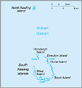
Cocos (Keeling) Islands are made up of a group of 27 small coral islands in two separate atolls in the Indian Ocean, 1,721 mi (2,768 km) northwest of Perth. West Island is the largest, about 6.2 mi (10 km) long. The islands became an Australian territory in 1955. In April 1984 the residents voted to merge with Australia. The population of the Cocos is 596 (July 2014 est.).
 Source: The World Factbook 2003 |
| Australia |
Trending
Here are the facts and trivia that people are buzzing about.


