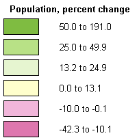
Montana: Population, percent change, 1990 to 2000

McCone County: -13.1Lincoln County: 7.8Sheridan County: -13.3Teton County: 2.8Daniels County: -11.0Lake County: 26.0Garfield County: -19.5Flathead County: 25.8Glacier County: 9.3Lewis and Clark County: 17.3Broadwater County: 32.2Valley County: -6.8Dawson County: -4.7Musselshell County: 9.5Fergus County: -1.6Golden Valley County: 14.3Wheatland County: 0.6Cascade County: 3.4Carbon County: 18.2Ravalli County: 44.2Missoula County: 21.8Powell County: 8.5Jefferson County: 26.6Yellowstone County: 14.0Treasure County: -1.5Deer Lodge County: -9.1Carter County: -9.5Phillips County: -10.9Toole County: 4.4Blaine County: 4.2Liberty County: -6.0Mineral County: 17.2Hill County: -5.6Roosevelt County: -3.4Petroleum County: -5.0Wibaux County: -10.3Pondera County: -0.1Sanders County: 18.0Judith Basin County: 2.1Prairie County: -13.3Sweet Grass County: 14.4Chouteau County: 9.5Richland County: -9.8Meagher County: 6.2Silver Bow County: 2.0Gallatin County: 34.4Custer County: 0.0Rosebud County: -10.7Park County: 8.1Stillwater County: 25.4Granite County: 11.1Big Horn County: 11.8Fallon County: -8.6Beaverhead County: 9.2Powder River County: -11.1Madison County: 14.4Carbon County: 18.2 Population, percent change, 1990 to 2000legend

Source information

Old URL
.com/us/census/maps/montana/population-percent-change-1990-to-2000.html