Italy Map: Regions, Geography, Facts & Figures
Welcome to Italy, a country of great historical significance, vibrant culture, and stunning landscapes. Located in southern Europe, Italy is a boot-shaped peninsula extending into the Mediterranean Sea and bordered by the Adriatic Sea. It's one of the world's most popular travel destinations, renowned for its art, cuisine, history, fashion, and culture. Its capital, Rome, is home to the Vatican City, an independent country within the city boundaries.
If you want to discover more in-depth information on Italy as a country, check out our Italy Profile!
Plus, test your country knowledge with our Italian geography quiz on the Italy Map!

See also: Sardinia map
History of Italy
Italy's history dates back to the ancient Romans, who built an empire that, at its height, extended across Europe, Africa, and Asia. The city of Rome (or Roma in Latin) was founded as a kingdom and later became a republic that conquered the Mediterranean world and ruled it for centuries. Italy became a nation-state in 1861 when the regional states of the peninsula, along with Sardinia and Sicily, were united under King Victor Emmanuel II. After World War II, Italy saw rapid economic growth, becoming one of the major economies in the world. Today, it is a parliamentary republic with its capital in Rome and enjoys a high standard of living.
Italy also shares a historical and cultural bond with Spain, a neighboring country in southern Europe. Although distinct in many ways, both countries showcase rich culinary traditions, vibrant festivals, and stunning architectural feats.
Geography of Italy
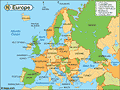
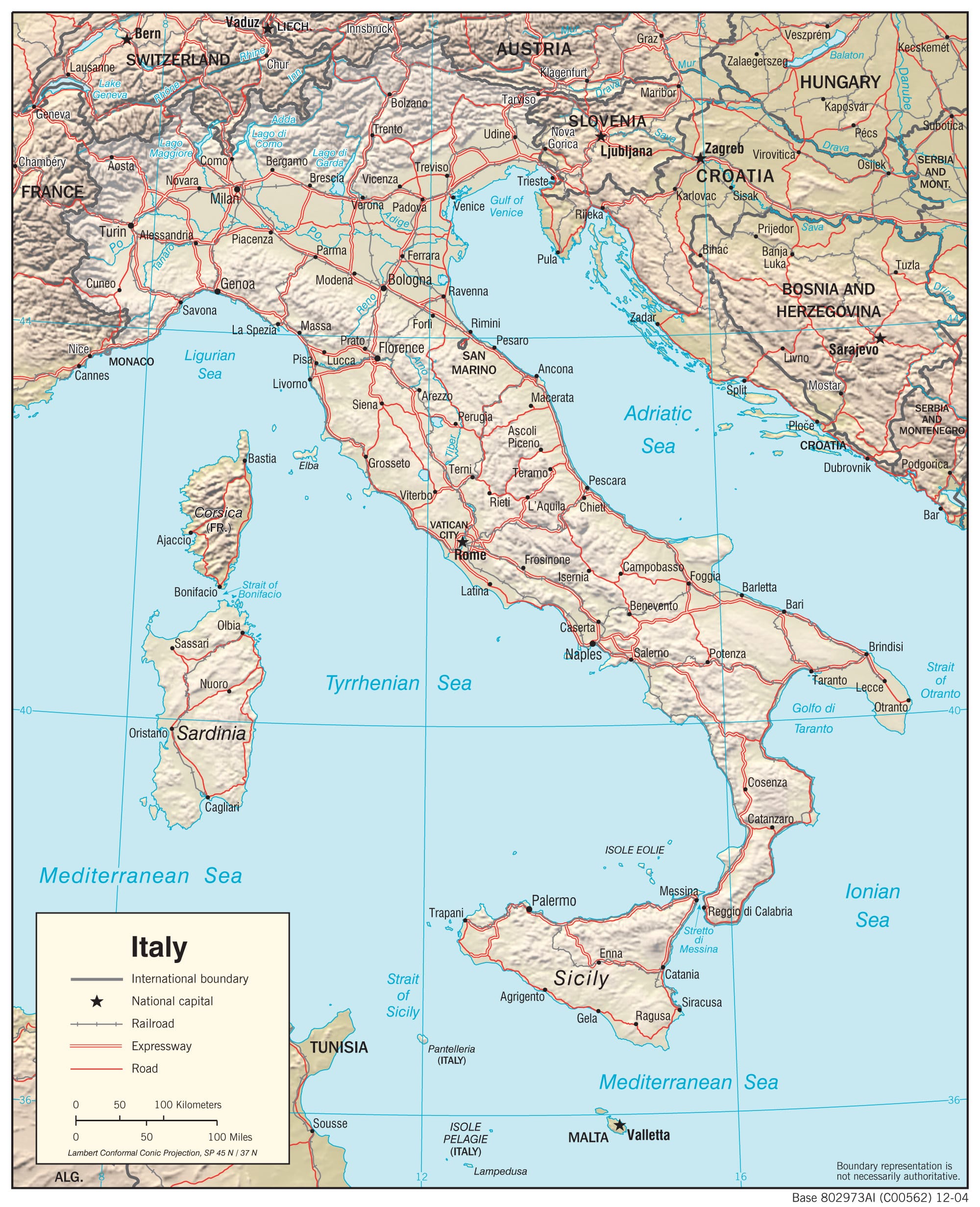
Northern Italy shares its Alpine boundary with France, Switzerland, Austria, and Slovenia on the world map. The country includes the islands of Sicily, Sardinia, and numerous smaller islands. The Apennine Mountains form the peninsula's backbone, and the Alps form its northern boundary. The country's total landmass is roughly 116,631 square miles, making it slightly larger than Arizona.
Italy's west coast is lapped by the Tyrrhenian Sea, a part of the Mediterranean Sea bounded by the Italian Peninsula, Sicily, and Sardinia. The sea provides a spectacular backdrop to the coastal regions of Tuscany, Lazio, Campania, and others.
Italy's major cities include Milan, Venice, and Naples, in addition to the capital, Rome. Other important cities are Turin in the north, Florence and Pisa in the heart of the country, and Palermo in Sicily. The regions of Italy, each unique in its own way, offer a diverse range of landscapes, cultures, and cuisines. From the industrial hub of Lombardy in the north to the sunny climes of Campania in southern Italy, there's something for everyone.
Tourist Attractions in Italy
A gem on the map of Europe, Italy is filled with countless breathtaking sights and experiences. On the north regions map, you can visit the stunning city of Venice (Venezia in Italian), fashion-forward Milan, romantic Verona, or the beautiful lakes Como and Garda. Explore Tuscany's rolling hills and vineyards, and don't miss the iconic Leaning Tower in Pisa. In central Italy, Rome's Colosseum, Vatican City, and the historic ruins of Pompeii are must-see attractions. The south boasts the picturesque Amalfi Coast and the volcanic Mount Vesuvius.
Italy's islands are not to be missed either. Sicily, the largest Mediterranean island, is known for its rich history and diverse architecture. Sardinia, on the other hand, is famous for its stunning beaches and crystal-clear waters.
Additional Italian Regions and Landmarks
Nestled within the Emilia-Romagna and Marche regions of Italy lies San Marino, a microstate recognized as the world's oldest sovereign state and constitutional republic. Its rich history and stunning architectural landmarks make it an Italian gem worth exploring.
Marche is an enchanting region known for its diverse landscapes, ranging from undulating hills to striking cliff-backed beaches facing the Adriatic Sea. Its charm is further magnified by quaint hill towns and rich gastronomy.
The majestic Mont Blanc, also known as Monte Bianco, towers over the Alpine landscape, marking the border between Italy and France. As the highest peak in the Alps and Europe, it's a notable spot for mountain climbing and features breathtaking views.
Moving further south, you encounter Siena, a city in Tuscany known for its medieval brick buildings and the fan-shaped central square, Piazza del Campo. Siena, a UNESCO World Heritage Site, is renowned for hosting the Palio, an annual horse race around the piazza that draws large crowds.
Finally, Veneto, a region in northeastern Italy, is most famous for Venice, with its intricate network of canals, historic sites, and unique culture. However, Veneto also boasts a variety of landscapes, from the Dolomite Mountains to the Adriatic Sea coastline, making it a diverse and fascinating area to explore.

People Also Ask…
If you're inspecting maps of Italy, you may have some queries about the region. Here are some of the most frequently asked questions, along with their answers.
What State Is Italy the Size Of?
Italy covers approximately 116,353 square miles, making it the 23rd largest country in Europe and roughly the size of the U.S. state of Arizona.
Where Is Italy on the Political Map?
Italy is located in the south of Europe, bordering France, Switzerland, Austria, and Slovenia on its northern border. The Mediterranean Sea lies to the south of Italy.
What Is the Physical Landscape of Italy?
Italy's physical landscape consists of rugged Alpine mountains in the north; hills and plains in central and southern areas; volcanoes, including Mount Etna on Sicily; coastal plains; islands such as Sardinia and Sicily; glaciers in the Alps; and several rivers, including the Po. The country's climate is predominantly Mediterranean, with hot, dry summers and mild, wet winters.
|
|
Trending
Here are the facts and trivia that people are buzzing about.


